photogrammetric mapping services - air sample

Map Works

complete photogrammetric services


Please click on images
to see
larger views

topographic map, topography


products and services

  • Flight Planning: Photo coverage of the project is laid out with consideration given to: specifications, control surveys, aerotriangulation, and costs.
  • Ground Control Layout: A map showing needed control points is provided to the surveyor. Map Works can assist on the ground if desired. In urban areas existing features can be used instead of laying plastic targets.
  • Aerotriangulation: Ground control costs can be reduced for large projects by mathematical contol extension across a block of photography.
  • Map Compilation: This is often a standard presentation. Please state any special interests (such as vegetation or test wells) in your project with the specifications.
  • GIS base: Water flow is compiled in downhill direction. Closed features such as water bodies and vegetation are compiled clockwise. Topology, connections, and direction can be compiled to your standards.
  • Metric Mapping: Map Works has experience delivering contouring in one, 1/2, and 1/4 meter intervals.
  • Contour Mapping: Mapping can show contours drawn or derived from DTM.
  • Digital Terrain Models: Most linear map features are compiled in 3D, they can be used as DTM for contour generation. Natural terrain features such as ridges and drains are compiled as break lines.
  • Orthophotographs-Mosaics: DTM features from the above work are used for highly accurate orthophotos that can be combined with the map.
 

303 667-3540

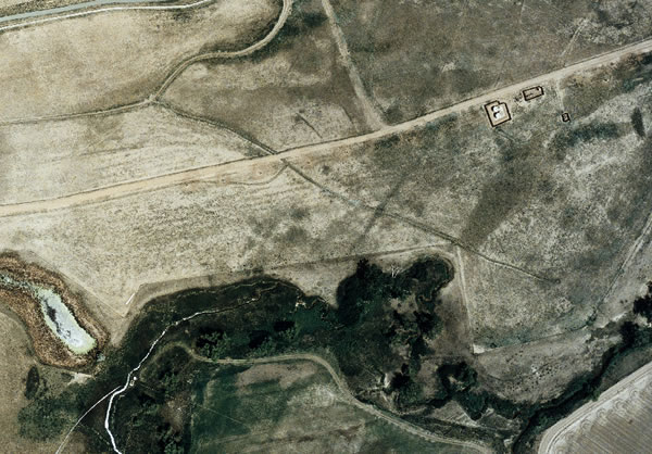
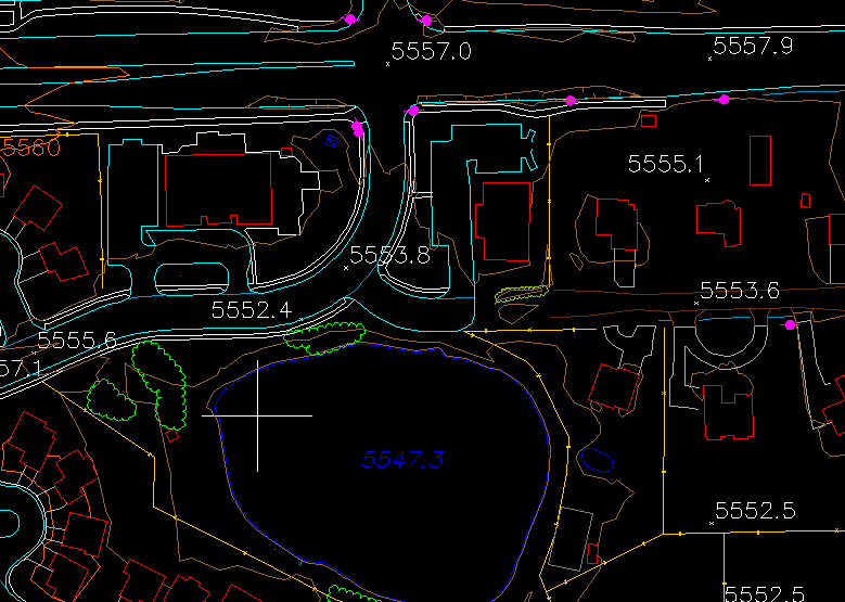
Map Works provides maps and performs mapping as a service using aerial photography. Interpolation of contours is included as a result of DTM -- digital terrain mapping -- collection. We specialize in orthophoto and use photogrammetric software.
Tags and keywords include map, mapping, contours, contour, dtm, digital terrain mapping, orthophoto, photogrammetric, and aerial.