Please click on images
to see
larger views
![]()
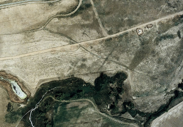
Map Works provides complete photogrammetric services.We specialize in large scale mapping and orthophoto mosaics. Our focus has been on providing 1/2 to 2 foot interval contour mapping and orthophoto mosaics.We provide fast and flexible service, competitively priced.
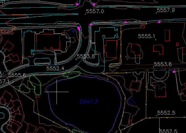
Map Works was started in late 1998 by Ralph Vomaske. Primary photogrammetric production is using softcopy (photogrammetric software). Map Works has primarily been producing 1/2 to 2 foot interval contour mapping and orthophoto mosaics. Typical workflow starts with bidding to specifications and a specific map area. Aerial flight planning and ground control are plotted to cover the project. Digital Terrain Mapping (DTM) collection or contouring are usually performed, along with planimetric mapping. Map delivery is in digital format. In DTM collection constructed features (such as ditch, road, and sidewalk) are collected in 3D for contour interpolation. This data is also usable for orthophoto mosaic generation, delivered in TIF format. Specifications needed for bidding include aerial photography (color or panchromatic), map scale, contour interval (vertical accuracy), and orthophoto pixel size. Existing photography from government sources is often available for projects of larger contour interval, where less recent photo dates are acceptable. This can greatly reduce the customers cost. Experience includes delivery of projects in metric units and for GIS base mapping. |
|---|
|
|---|
Associate Member, Professional Land Surveyors of Colorado |
303 667-3540
Map Works provides maps and performs mapping as a service using aerial photography. Interpolation of contours is included as a result of DTM -- digital terrain mapping -- collection. We specialize in orthophoto and use photogrammetric software.
Tags and keywords include map, mapping, contours, contour, dtm, digital terrain mapping, orthophoto, photogrammetric, and aerial.